Monday 31 October 2016

Pop it on a Postcard

The fascination of an old postcard. Especially those that were written on and posted. You can look for the address…is it still there? How long did they live there? What was their life like?  You get the tiniest glimpse sometimes from the message.  Just maybe you could begin to craft a whole story from it.

A couple of years ago I went to a vintage toy fair at Doncaster Racecourse. I found a big box of postcards, all for a fiver. Oh the heavenly joy of going through them and reading them all. This was obviously a collection. I worked out that it had belonged to a lady that lived in Dawlish.  I got to know her quite well from the postcards that she had saved from family and friends. But there were some older ones that she must have bought or been given.

Here’s a couple:


A typically English postcard...a model village

Jalland Street is still there!  Google image it to see a row of middling-class terraced houses

Some scenes are a bit boring and unlabelled. No idea which church this is.

It's still there...slightly better class than Jalland Street, above.
Was sending postcards a purely middle-class activity?


 I’m selling a few on ebay…keeping the ones of special interest to me and then giving others the opportunity pick up some that may be of interest to them. It means that I got my fiver back, and have had tons of free geographical-based entertainment!

Monday 10 October 2016

Bartholomew's Sheet 29

This is my favourite map of all time, and it shows clearly why I find these things so interesting.


It is a Bartholomew map, which states that it is by appointment to the late King George V. This suggests that it was produced in the latter half of the 1930s, a most fascinating period of time.


Part of my love for it is that it maps out my favourite places to be…ones of memory and aspiration. Monsal Dale, Derwent Valley, Hope Valley…I would be there every day if I could.


But my original fascination, the reason why I had it on my bedroom wall as a teenager, is that it is a map of where I grew up. A place of great change. This sheet of paper was my portal to the past; my own Narnia.

In the late 1930s, the area where I was living had been part of Derbyshire, it had been a place of coal mines, railways and the most polluted river in Britain that would flood and cover those train tracks. But around the time when I was born, Sheffield had stretched its boundary and embraced the area into the suburbs. Huge council estates were thrown up, then private housing and then finally a shopping centre.  I witnessed this, as we were one of the first families to move into the council estate.  I played on the buildings sites and mourned the loss of my favourite dog walking field to the foundations of the shopping centre. That country road that was dotted with benches and little white bungalows now sits under a retail park. It was like a scene from one of those old 1930s films that I liked watching. But my map kept it alive.


These railway lines were of particular fascination. One lives on, the Midland ‘old road’ between Chesterfield and Sheffield.  But the others in this tangle have gone. I found out that one was once the Great Central main line, and that express steam engines shot down it, heading for Marylebone. This fuelled my imagination and I took my dog and explored the old grey path of ballast.  I found all sorts down there in the 1980s when it had merely been abandoned – not tidied up and turned into the Transpennine Trail.  When I began to organise Young Archaeologist Club trips, I took a group along with me and we had a whale of a time exploring the site of an old signal box.


The city still encroaches into this place of contrasts, and sucks the character from it. But I still have my map and my imagination.  This is the only map that I will never upcycle. 


Tuesday 23 August 2016

Back to School with your Map Notebook

I’ve covered the subject of map-covered writing books before, but I am just returning to it for a quick post because I think I have found the best notebooks to use!

Backing a plain notebook with an old map is a terrific way to show it some new love. I find staring at a map very cathartic while trying to write, I can chuckle at place names and take myself off on an imaginary historic journey through bits of old Britain, now lost forever. It makes your notebook both more inviting and more durable.


I have just backed a pack of books, and have placed two of these for sale in my Etsy shop. The others are for me. The notebooks that I have used are standard school writing books, and I purchased a pack of five from Ryman’s in Buxton at a very reasonable price.  The picture below demonstrates how I have covered the book and how easy it is. You just need an extra strong Pritt Stick to hold it all down.


Buy one of the finished books here for £2.99 plus postage, if you haven’t time to make your own.


Monday 20 June 2016

Vintage Map Confetti

Oh the fun you can have with a shaped hole-punch!

I have turned an entire 1940s map of the Plymouth area into butterfly shaped confetti. A very cathartic activity when there are certain pent up frustrations that you are unable to demonstrate in the preferred manner.


These little 2cm mappy butterflies might be used as table confetti at a party or wedding – maybe in the Plymouth area itself.  They might find their way into invitation envelopes…or in a bon voyage card for someone off to live or study in the Devon city.


Anyway they are now for sale in my Etsy shop…or if you fancy making your own then the shaped hole punch is easy to obtain on ebay. Happy punching!

Thursday 26 May 2016

Table Top Tour

I occasionally visit a café in Buxton (Charlotte’s, in the old pump rooms) which has decoupaged some of its tables. One of those has been covered with sections of old map. I presume that this is a plain wooden table which has had the map pieces pasted on. There seems to be a really thick coating of varnish on the top, which does make the table feel a little bit sticky.


But I do love this particular table and make a bee-line for it, if the really comfy settee is taken. What better way to take your tea – sipping it from a china teacup while being able to select my piece of the British Isles to take an imaginary tour round. I got a bit of Dorset at my elbow last time I was in…my favourite!

Wednesday 13 April 2016

The Tale of a Tea Towel

Occasionally you can go off-piste and find a map on something other than an Ordnance Survey sheet.  Postcards are one example.  Or the good old holiday souvenir tea towel. I have a couple of these stashed away – my Mum’s collection from our 1980s holidays in the south west that she didn’t like to spoil.

These geographical tea towels make ideal pillow covers – they are just the right size.  This means that you can put your old holiday memories to use without having to spoil them through wiping your pots on them. 

All you need to do is cut an old pillow case in half along the seams – then sew one of the pieces onto the back of the tea towel.  I hand back-stitched mine using my old Sylko cotton, leaving the bottom open to insert the pillow.


Now they make a comfy cushion for a bucket chair.


Sunday 3 April 2016

A-Z Necklace

I recently found an old A-Z map of London, and thought that this would make an ideal resource for my crafts.  I’m currently working on a piece of mixed media art using the page showing the very heart of the city. But I have also made this silver necklace which features Piccadilly Circus.


Piccadilly Circus, with its iconic Eros statue will strike a note of fondness for any London lover or Anglophile. Even as I type this, I am humming to myself the line from the old wartime song…”goodbye Piccadilly, farewell Leicester Square…”  It’s an unusual name, resonant of flashing lights and seedy backstreets.  Apparently the name comes from a lacy collar – which a purchaser of the land in the 17th century had made his fortune in producing.

From collar to necklace, it’s all quite appropriate.


The necklace is now on sale in my Etsy shop:

Monday 21 March 2016

GeoGift Wrap

If you are planning a gift for a keen geographer-type – or indeed someone who is about to set out on a voyage – wrap it in an old map. It’s very easy, no instructions are needed from me, though I would recommend you use a paper map rather than cloth bound.  It’s much easier to manoeuvre.  They are available in charity shops everywhere, and tend to cost less that a roll of brand new purpose-made wrapping.  I would suggest tying a bow made of garden twine rather than ribbon – it just suits the look much better.


If you just want to add a mappy touch to a gift, rather than go the whole-hog, try a gift decoration like this one that I made last Christmas. 


This was made from a cloth bound map.  I used my pinking shears to cut out some ever-decreasing circles, making sure that I layered some plain blue sea pieces into the mix for a nice contrast. I then topped these with a vintage metallic button and lay a length of ribbon directly underneath. I sewed them all together with strong thread through the button holes. This lay across the top corner of the gift. You will see I used a hand sewn postcard for my tag. I traced 1950s flower patterns onto a plain postcard and sewed over them using embroidery thread.

***
I have a new book out called ‘Sewing With Sylko – A Treasury’ – my tribute to this iconic cotton reel and the delightful names of the colours. Order your copy here:


Friday 4 March 2016

Bon Voyage!

Old maps make the perfect decoration for a bon voyage card.  You could use a map of the place that the recipient is heading for.  Alternatively, a map of their home area serves as a nice reminder of where their heart will always lay.  An especially pertinent use for one of these would be a good luck card for someone off to study Geography or a connected subject at university. Or a congratulatory one for their graduation.  The recipient might simply be a person who likes maps.  I would be very happy to receive one! 


Decorate the maps as you please.  On these ones currently on sale in SewsAttic I have added fabric scraps and buttons. I also made a card once that featured cross-stitched Ordnance Survey map symbols. They were fun to design!


Monday 29 February 2016

The Autobiography of an Antiquarian

From my wordpress blog: Adventures with a Notebook and Biro:

I love to read an autobiography.  I don’t care if the author was famous or not – I just need them to have lived an interesting life or been through interesting times.  I say was famous in the past tense…I only read books from the mid 20th Century, and most of the authors are now gone.  My current read is Agatha Christie.  I have been through the First World War with her and now I am out doing archaeological digs in the Middle East. Some of her words jar the modern reader, but they make you assess how much has changed and how we as humans have improved or deteriorated.
I wondered what would happen if I ever wrote my autobiography.  What would I focus on?  What times have I lived through?  I decided that as history and old things have been the over-riding interest in my life so far, then this should be my starting point.  I have tinkered around with a couple of memories of places that I think have some importance on how my life has turned out. Maybe these are of no interest to anyone but those who lived it with me. But here we are…4 short essays.
Industrial Revelations
River Don Engine image
Kelham Island features in the River Don, just a little to the north of Sheffield City Centre. On each successive visit that I make, a little bit more smartness appears. The scum went off the top of the river.  Then apartments shuffled their way in and they made the roads better. But as I write, there are still fascinating glimpses into the area’s past purpose. If you get off the tram at the bottom of Infirmary Road and walk towards the Fat Cat pub, you can marvel at the blank facades of Victorian works and covet 1930s style windows with an archaeology-thick coating of grime.
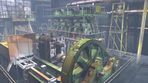
Negotiate the apartment blocks and you will eventually reach Kelham Island Museum. Amongst the thrusting-forward blocks sits a sample of our working past – what Sheffield made and what machines were used to make it with. You can’t miss it.  There’s a massive Bessemer Converter sat outside.  I find the thing a bit menacing, like I have some genetic memory of the tyranny of steel making.
It was a dangerous job, and my ancestors gave up English pastoral living to come to the city and do it. The coastal farmlands of Cornwall and Somerset and the Cotswolds were left behind for the smoke and clang of industry.  Quite possibly, the shell of the dwellings that they abandoned could fetch a fortune today as a second home.  But at the time, they would have been little more than hovels.  It was a hand to mouth existence, dependent on the English weather.  Too much rain, too much sun and you went hungry.  So the call of regular dependable work won, and they settled here.
Steel was a lucrative industry.  It spread out along the valley of the River Don.  More ingenious ideas were thought up to make the stuff better, quicker, bigger. These things are now are for display only, exhibits to tell us what it used to be like.  The exhibit that speaks to me most about ancestral conditions is the River Don Engine.  It fills a room on its own, this monstrous piece of engineering. Three or four times a day they set it going, its arms revolve slowly at first, then it speeds up, pinning me to the wall in fear of a part of it sheering off and causing havoc in its momentum.  But the most effective aspect is aural. It is the rhythmic boom of the Engine that is the most fascinating.  It makes me consider the time when there were many engines like this one sat in the valley bottom.  What must it have been like to have to listen to this in multiple  every day, all day. To get to the point when you only notice that it has stopped.
The terraced houses clamber up the hillside of Grimesthorpe, where my Great Grandmothers came to live.  This boom would have sounded in the ears as they pegged out their washing, and been barely muffled when they shut the thin wooden back door.  Not the clatter of a tea cup or the singing of a kettle would have offered respite from the sound of work. So different from the birdsong or the sound of the wind on a clifftop field.
It is a wonder that they didn’t go mad. Such stoicism created me. But this noise faded as I was born and was replaced by the sound of construction and modernisation.
My Trig Point
5484717837_39fc34a854_b
My first home was on a post war housing estate along with my parents and grandparents.  Legend has it that the city is built on seven hills, and this estate breasts the top of one of them. Stand on one side and see the red brick boxes snake down into the valley.  Turn around and see the start of Derbyshire, green undulations that will ripple on into the hills of the Peak District.
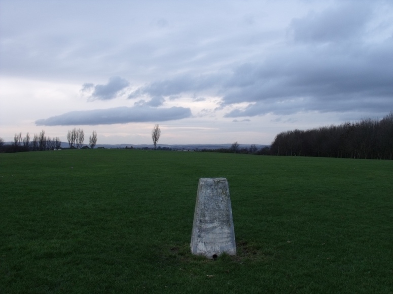
The best place to stand around here is the trig point on the top field. Presumably this is the highest point in the area, it was certainly the windiest as I recall. This white painted triangular post was an ancient monument to me.  To get there, we would have to pass the much older farmhouse at the top of the street. The poor old stone cottage, its pastoral idyll had been swamped by semis in the modern style. But I ignored this much older historical marker as just another house back then.  I hope that this was down to the way that it had been overwhelmed by a greedy city rather than my own ignorance.   But in the end it was a house, and I had seen lots of them before.  The post on the hill was something different.  It seemed to come out of the storybooks with spotty toadstools.
A painted concrete triangle sprouting out of a field does appeal to a sense of intrigue, even before we are old enough to understand what that is.  A little person like me could be lifted onto the top of it for a short sit down and a better view. It’s one of the best seats I ever had.  I never gave any thought to what it was.  I heard it called trig point but this was a name without meaning until I was much older.
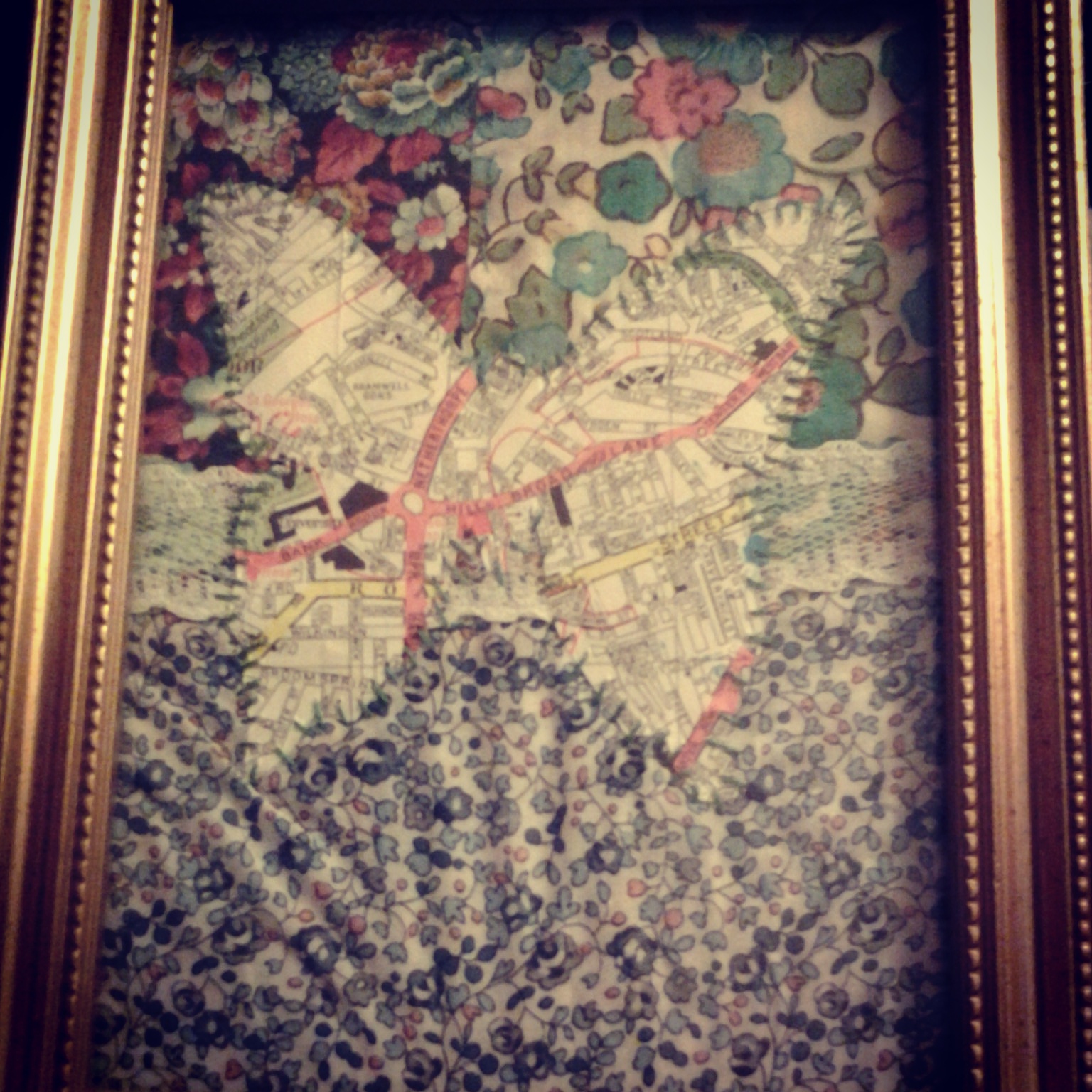
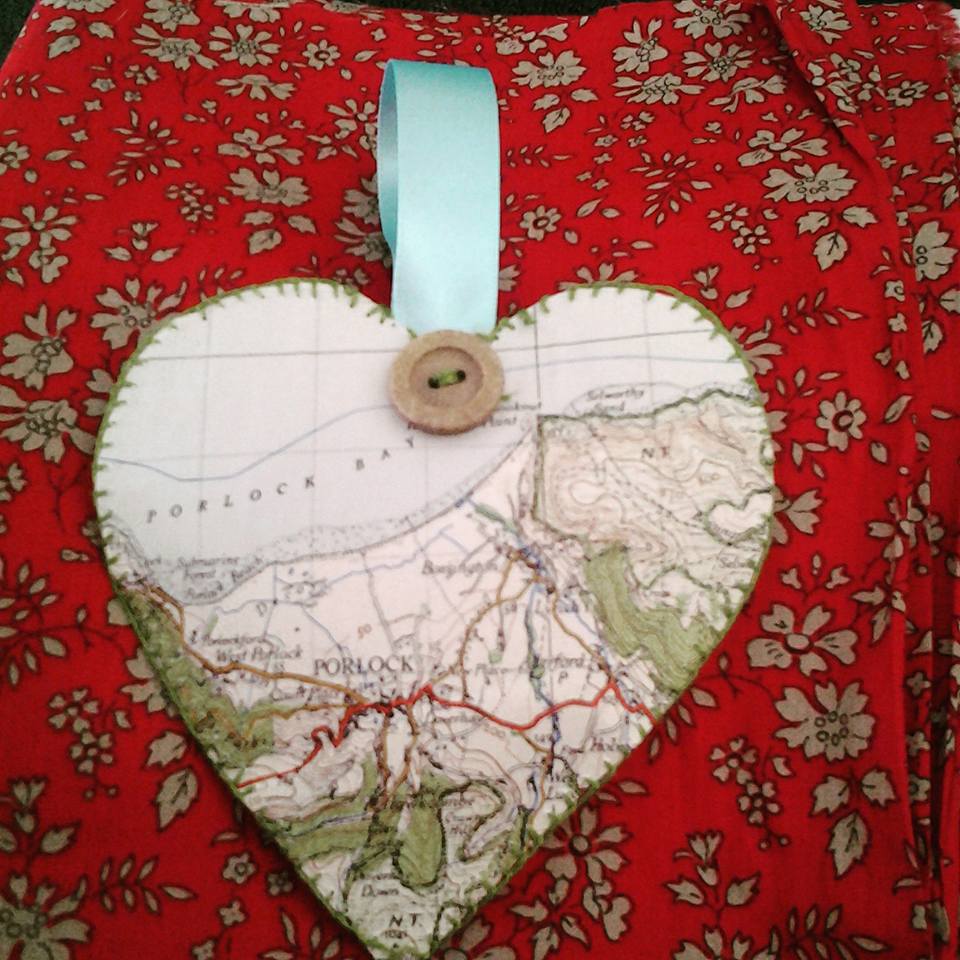
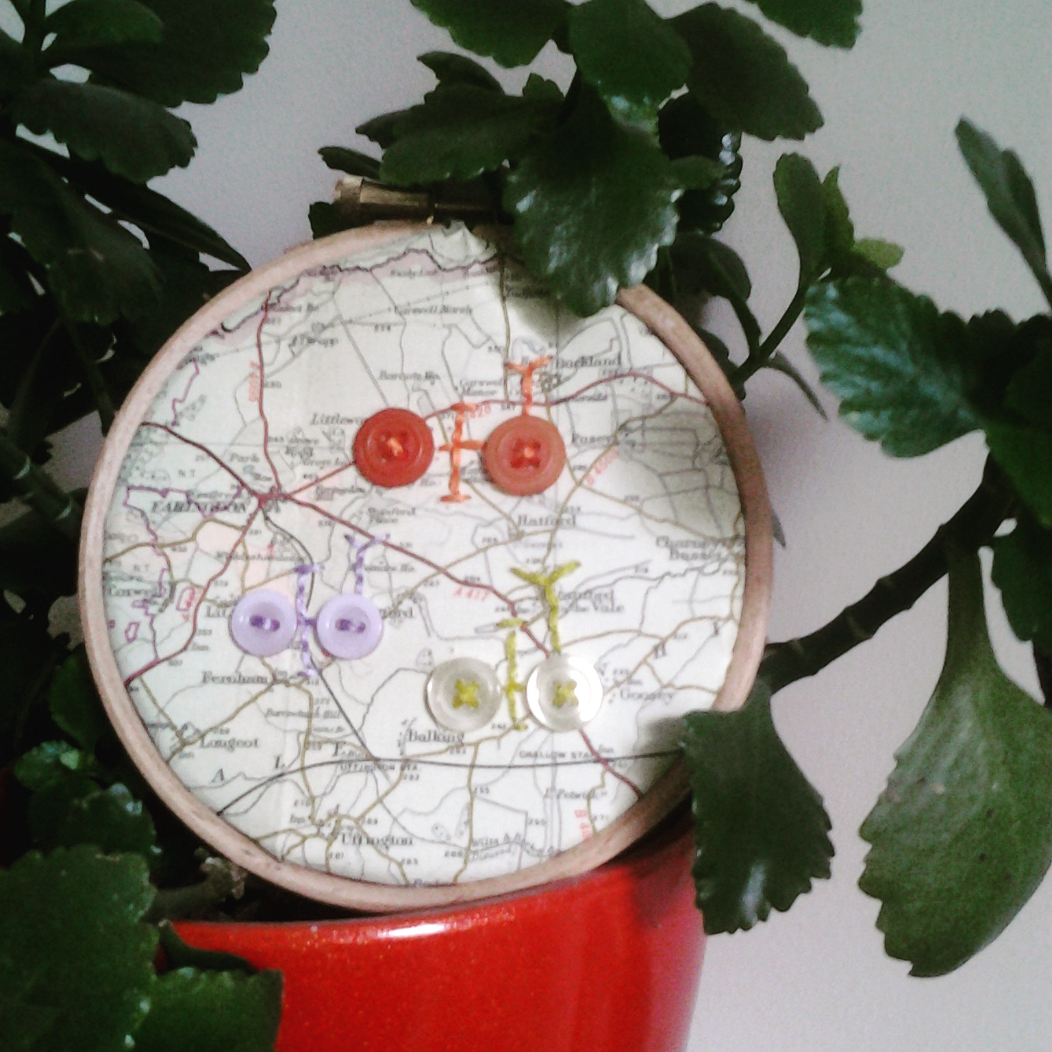
Now I do know what they are. They were put there by the Ordnance Survey in the 1930s to enable a modern, accurate mapping of the whole country. There were hundreds of the things, each within sight of two others. Primitive now, but ingenious all the same. I love an OS map.  I pore over them looking for daft place names.  I make things out of old ones to try and put them to good use. They are historical records of how we used to look.  Did it all start there, at the trig point? Did the cartographer’s magic soak in as I sat there?  Funny of one of my early jobs was with the Geographical Association.
A Hole in a Road
HOLEINROADii
Sometimes landmarks are lost before they have chance to become a historic monument. I would give this label to the Hole in the Road.
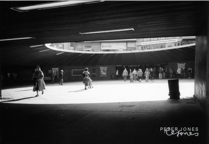
My first home was a 3 generational one – it wasn’t so unusual in the 1970s to live with extended family.  It will become normal again – the population grows faster than housing, and prices are out of reach. But for a while, it has been the thing to aspire to – your own home where you can live independently. So eventually I moved into a flat with Mum and Dad, the 13th floor of a high rise overlooking Sheffield City Centre.  Overlooking the new concrete showplace with its underpasses, covered walkways in the sky – and a great big hole in the road. Castle Square, to give it its official title that was never used, was excavated out at the end of the 1960s. That bit of town had never really got over that night that the Luftwaffe paid a visit.  So someone at the Town Hall decided that we needed to bunker down a little bit while we did our shopping. This underground square was reached by a network of slopes, steps and jerky grey escalators. It was partially roofed over, with a big circular opening in the middle. As viewed from above, this opening was the hole in the road.
My overwhelming memory of this period of my life is tropical fish.  The Castle Square aquarium probably looms large in the memories of many people of my age bracket. No trip to the shops could be completed without a good gawp at the poor creatures moping about inside the tank.  One night, I fell ill with tonsillitis, and became delirious. I remember vividly laying in my hot little bed in the sky and seeing tropical fish swimming around my head.  My only experience of fish had been at that fish tank, and I have no doubt that this is where the vision came from. I feel it was a strong formative influence.  Ever since then, I have hated the sight of fish.
The dark passage ways and faulty escalators doomed the Hole in the Road to eventual obsoletion.  A planner’s “Let’s put it down to experience”.  When the new tram system was built in the early 1990s, it was filled in and a tram stop plonked on top. But those of us who remember it do so with a kind of perverse affection. It was awful towards the end, but we all knew it and walked through it every week.  It was on the way from the bus station to the shops, you couldn’t avoid it really.
It is a marker to so many of us, like a lot of things that are protected now were memory points for our ancestors.  Its name will live on as long as my generation do…and one day, maybe a team of archaeologists will be faced with a very interesting underground labrynth and excavate it with excitement at what they might find.  I wonder if there are any fish skeletons down there?
A-Spire
!BpKwwtgB2k-$(KGrHqMH-DUEu,mHhph5BLqQbByFvQ--_35
When I was growing up, Sheffield was a hungry city. Slum clearance had displaced so many people, and a lower population density was now required.  They built upwards.  It wasn’t enough.  So Derbyshire had to surrender to the urban sprawl. Once the new boundaries were set, the space was filled with new tarmac streets and various types of housing.  I suppose they wanted to see which type worked best. While all of this building was going on, we were moved from our city flat to this newest part of the city. It was still a massive building site when we arrived.  The school hadn’t even been completed yet, so all of us young pioneers had to be bussed elsewhere. Acres of mud and stacks of bricks were our playground at the weekend.
This is where we stayed put. The question I sometimes ask myself is – do I love sites of antiquity because I was so deprived of them in my formative days? I grew in a sea of new, and anything old was really rather magical.
I remember fixating on two sites during these years. There was a stream laying down a pastoral corridor through the developments.  Designated green spaces were placed along it, with the occasional playground and clump of trees. Naturally, we saw the waterway as an extension of our play area.  We had our ‘jumping across it’ contests, or we pulled our little black wellie boots on and waded down it. At one point, the stream bed seemed to be paved.  We called it the Roman Road – these stone slabs had certainly been there for a long time. But as for their date or purpose, I am still unaware.  Perhaps this was my first experience of the fact that some antiquities are more difficult to explain than others.  Not everything in our landscape is obvious or documented.  They just sit there, soaked in for so long that the meaning has ebbed away.
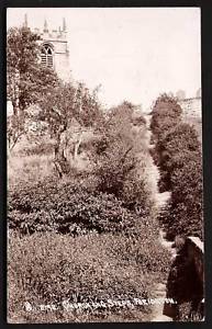
As I grew, I was able to venture further downstream. This would take you into an older village, one that had become the eye in the storm of new estates. The old village centre was overlooked by a church, perched on the top of a slight mounding in the landscape. I never went inside, but the churchyard became a favourite hanging around space during my teens.  I particularly enjoyed the steps up from the path that followed the route of the stream.  They were made of stone, and must have been contemporary with the church itself.  Each step was worn into a shallow concave shape, the rubbing of over a century’s worth of feet. Evidence of people who had hauled themselves up for funerals or Sunday Evensong, or taken a short cut to and from the fields or the coal mines.  This became my place to ponder.  I’m not religious, but I can sympathise with a lover of old churches, often the only solid remnant of local history; representing the sense of place and the people that have lived in it. I want to know more about the people that once used the church, as everyone had to do. What did they think about while walking to church?  What sins did they worry about while sat in the pews? What was the gossip whispered in the porch? For every person, a story.  I decided that I wanted to tell some of them.
#Sheffieldissuper

Sunday 21 February 2016

Go By Butterfly

Have a look around and you’ll see that the map heart picture is fairly common.  Sites like notonthehighstreet.com sell personalised pieces of map artwork that can show your place of birth, marriage etc in an Ordnance Survey heart.  It’s so simple anyone can do it for themselves for much less money. I had a bit of a go at this kind of thing but then I did this, which I much prefer:


I cut out my place of birth in the shape of a butterfly, and sewed it onto a Liberty print floral background, so it was like a butterfly resting in a flower patch. How I like to see life...we are but brief beauties enjoying a short time in the sun.  I stuck it in a vintage style metallic frame and hung it in my sewing corner.  I find it all rather pleasing. You can find a butterfly template online with a bit of a search round, and apart from your materials that’s all you need.

Wednesday 10 February 2016

Vintage Map Notebook

Back in the early 1990s when I was a student, Woolworths sold some stationery made from defunct Ordnance Survey maps.  As you can imagine, I was all over it.  Many of my contemporaries went on drink and cannabis binges.  I went on a map stationery one. There were notebooks, writing pads, notelets…oooh allsorts. I was bereft when they stopped selling it.  All I have left now is a hardbacked A5 notebook, which I use as my travel journal. Since about 1993 I have been recording every new place that I have visited and making a brief comment, fancying myself as Pevsner or Betjeman. Since I had children the entries have dwindled considerably, but it is still there in its own little place on the shelf, awaiting a rosy future where I throw off the shackles of working motherhood.

But I look at this very apt map-covered travel journal and I want more notebooks like this. When you’re having a think about what to write next, you can go on a little journey just by closing the book up. You might see a place name that inspires you.  I searched ebay, hoping that someone would have conveniently bought a stash of this stationery and never used it. I was out of luck.  The only thing left to do was make my own.


So, I bought a softbacked exercise book – the sort they give you at school, which cost me about 75 pence.  Then I covered it with a paper map, sticking the edges down with good strong glue.  It was just like being back at comprehensive when we had to cover our books with old wallpaper. It’s not quite the same as that old Woolworths one that I have, but it’ll do. And it's cheaper than those fancy notebooks that they sell in Paperchase, which I'm not the slightest bit in love with, oh no.


Monday 1 February 2016

Outside Gets Inside

I’m a fan of using an old map to find out why things are as they are. Why are there two roads running parallel? Why is there a linear ditch there? Why is there a big gap in that row of housing? Look at an old map and you might find out.  I once traced a whole railway branch line using old maps – which made me look upon my environment with a new understanding.  ‘Tracing the Birley Branch’ was published in the Great Central Railway Society journal, sometime in the mid-late 1990s.

So when I wrote my book ‘Outside Gets Inside’, which is about a 1940s body being found in a 1980s garden, of course I had to bring the maps in. When the police try and find out why the body is there, the person that they turn to is the local historian. Here’s an extract:

Priestley took his leave of Margaret as she left for work.  He spent ten minutes watching the work and helping to position the barriers. He saw the pair of eyes peer from behind the curtain in the bedroom next door, and he was determined that they would see nothing. The local historian arrived shortly after.  Dressed in varying shades of tan, he strode into the garden with a grey box file under his arm.  Priestley shook the historian’s hand and led him over to the garden bench, which had been left in a skewed position beneath the living room window.
“Mr Stanley, glad you could come and help.”
“Only too pleased.  Now then.” He began to rummage in the box file and pulled out a copy of a 1940s Ordnance Survey map.  He unfolded it out across his lap and slid it along so that it partially rested on Priestley’s leg.
“You wanted to know about this site in the late 1940s.  This is a map dating from 1948, and this cross here is where we are now.”  Mr Stanley’s finger rested on a pencil cross. “I superimposed a modern map of the same scale on top and was able to pinpoint this house. I am confident that x marks the spot accurately.”
“So what stood on this site then?  Was it waste ground?”
“That’s correct.”  Mr Stanley took a pencil out of the box file and began to lightly sketch an L shaped box on the map.  “This is the position of the actual Miles and Malleson factory. We are now sat in the position of an office block, which was demolished by the Luftwaffe attack of 1941.  It would have been impossible for a burial to take place while the offices were in position and they were constructed in 1894.  No casualties were recorded as a result of the bombing of the office block.  This building was unoccupied at night and the raid took place at ten pm.”
“Good.  Well, that tallies.”  Priestley stretched out his legs. “The position of the body suggests that it wasn’t deliberately buried there. That the body was dumped or fell into position.”
“Now.  I have some interesting recollections for you of this place after the war ended. I was a boy then, and I used to play on old bombsites.  I remember this one and….”  He rummaged through his box again “I have a photograph and newspaper article to corroborate some of what I can tell you.”  He passed the picture, which was copied from a grainy old newspaper. Two columns were written underneath it, headlined
‘Local children urged away from Miles and Malleson site’


You can read ‘Outside Gets Inside’ by purchasing this novella as a download or printed book from Amazon here:

http://www.amazon.co.uk/Outside-Inside-Sarah-Miller-Walters-ebook/dp/B00ZIEJETQ

Monday 25 January 2016

Sewing + Lavender = Relaxation Squared

I grow lots of lavender in my garden, and I never let the flowers go to waste.  My earliest sewing projects were always lavender bags, and every August I carry on the tradition.

Last year, I experimented with using the old cloth bound maps as the fabric for the bags – or perhaps sachets is a more appropriate name. I cut out two heart-shaped pieces of map and blanket stitched them together, leaving a gap at the top.  


Dried lavender flowers were stuffed into the opening, along with a ribbon hanger. I then sewed it all together and attached a button for good measure.


The smell of the lavender permeates through the cloth bound map very well – but the sachets are far too fascinating to be shoved into the bottom of a drawer!


Monday 18 January 2016

Cartohoops!

Maps are, to me, a work of art. My favourite art has always been that mid 20th Century genre of simple, clear-lined landscapes. I love a good lino print and admire the work of artists such as Ravilious and Bawden. I don’t think it is a huge step from their work to that of the OS cartographer. I can visualise the landscape marked out in the intermingling of a railway line and a river. I could stand and stare at a map for much longer than I could a painting.

So, I have little pieces of map artwork about my home. Here are a couple of examples of what I call my Cartohoops.  I have put a circle of cloth bound map into an embroidery hoop (not as easy as it sounds!) and used a needle and thread to just augment them a little and make them mine. 


For the first, I used embroidery thread to pick out some of the features. This shows a place where some of my ancestors came from so it is part of my family album collection.


For the second, I had a bit of fun trying out a piece of artwork aimed at pleasing the keen cyclist, by using buttons as cycle wheels and embroidery thread as the bike frame. A design I picked up on Pinterest.


Have a play and see what makes you smile!

Both of these pictures are from my Instagram account - @Sarahmillerwalters

Thursday 14 January 2016

Save the Place


This bookmark was made using two rectangular pieces of cloth bound map,  A piece of felt was sandwiched inbetween to give it some body. The whole lot was blanket stitched together using Sylko Dark Reseda.

To finish off I fastened a vintage button and a piece of ribbon to the top, which stops the bookmark sliding out.

Visit the Sylko Colour Name Archive

Friday 8 January 2016

The SewsAttic Needlecase!


Needlecases made from vintage cloth bound maps
I have been making these for a while now, and I have sold one or two in my Etsy shop. A couple of buyers left lovely feedback including:

What a great little needlecase! Really quirky and fun - and came complete with some buttons, needles and pins! Thank you 👍

This needlecase is lovely. The hand-finished style is nice and the real bonus for me is that my village is featured on this vintage map cover.


I’m not sure where I got the original idea.  Obviously I spend a lot of time looking at needlecases.  I did buy a fabric one from a craft stall and study how it was put together, with a mind to making my own. But the use of a cloth bound map as the outer shell must have come out of the blue somewhere.  Possibly it was wine-fuelled.

The traditional folds of an old map make a handy template for this.  Cut out one of the rectangles made naturally by the folding action. 

Cut out a length of fabric to act as the inner lining, to the same size.  I use pinking shears to prevent fraying and give a nice scalloped edge. 

Get a small rectangle of felt and stitch it into the middle of your lining fabric, folding both in half to get the crease to stitch along. 


Then, stitch the lining fabric to the inside of the map, using backstitch.  Of course, I always use a vintage Sylko thread to do this.  I find that Lime Tint often blends in well with a map that contains a lot of green shading. Solent would be a good blue shade for a map of the coastline – but of course you can use whatever shade you think co-ordinates well with your materials.

While attaching the lining, ensure you slip in the ribbon ties halfway down each of the short sides. Give them an extra bit of backstitch to ensure that they stay in place.


Finally, add a couple of pins and needles to your felt, and the odd vintage button to complete the look. 


Nobody else with have a needlecase exactly like yours…and you can gaze lovingly at a favourite location as you pick out your needles.